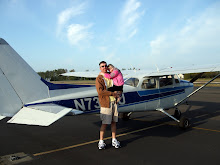
1.9hrs - Cross country including flight plan, filing/opening/closing a VFR flight plan, fight following, tracking VOR’s, GPS, and beautiful scenery.
This lesson was a cross country to ONP (Newport), which I was really looking forward to. The weather was perfect, the Newport area of the coast is somewhere I’ve enjoyed visiting most of my life, and my sister Teresa would be along. Beside a skydiving trip about 10 years ago, this was her only GA experience.
We got out to the airport a little early, so while we waited for my airplane to be available, and my instructor to arrive, I went over the sectional and AFD with Teresa, and explained a little about what we’d be using for navigation, the altitude we’d be at, and points along the way.

We spent a little time in the classroom going over the flight plan I’d come up with, my instructor walked me through filing a VFR flight plan, and off I went with my Teresa to pre-light the plane.
We departed 7S3, and tracked a heading from the Newburg VOR. I got off the heading a few times, and ended up zigzagging across it a bit while I got the feel for it, but finally settled in.
 Teresa asked questions along the way, and seemed to really enjoy all there was to see from 4500ft.
We hit my checkpoint just pasted the estimated time, and pretty close to over it, but probably would have been right on if it weren’t for the earlier zigzag course.

The trip across the coast range was smooth and beautiful, and we were soon on the descent for ONP.
We were originally set up to enter right traffic for 34, but ended up following another aircraft on a straight in approach to 16. This made for a nice approach over Yaquina bay, and the bridge, as well as a campground we’ve been to many times.
The landing was fair. I was off to the left of center, with the nose off to the left a bit. I just can’t seem to get past that, and it’s frustrating…

We taxied for a departure on 34, closed our flight plan, and opened our next (cool), and off we went.
We followed the coast north about 25nm, over a couple lighthouses, headlands, viewpoints, and other spots that have been favorites from the ground. Amazing!!
At Lincoln City we turned inland, and picked up the Newburg VOR. After climbing to 5500, we requested and received flight following. My VOR tracking on the return trip was much better.

Once we cleared the coast range we began our descent, ended our flight following, and turned north for 7S3.
We cleared the ridge and entered the Tualatin valley were 7S3 is located father west than I’ve become accustomed to, and suddenly everything looked wrong. My instructor asked if I had 7S3 in sight. “No, I do not”. It was right in front of me, and I was still at 3000 and 100kts. So now I had to turn to the right and try to lose some altitude and speed quickly.
How could I have not realized where we were crossing the ridge? I knew we were turning before reaching the VOR, and we usually cross in the vicinity of the VOR, so it's simple logic that I’d be heading right for runway 02 at 7S3.
I got down to pattern altitude, and entered the pattern. I then dropped below it, and was slow to regain the altitude. Arrgg… I finally got back on track, controlled my descent well, but landed again with the nose to the left, but at least on center.
Teresa, being great, commented that both takeoffs and landings were great (thanks Teresa!).

Cross country is good stuff!
The great pictures from this trip were taken by Teresa.

No comments:
Post a Comment